Listen here:
Around the globe, several industries have put up the shutters over the last few weeks on account of the coronavirus (COVID-19) pandemic. This unprecedented crisis has sent millions of employees home on an indeterminable break and has forced millions more to create makeshift offices in their homes. The agriculture sector, among many others, is facing immense difficulty in working around the severe limitations imposed by various countries to curb the explosive spread of the virus.
With at least one-fifth of the world exercising a lockdown along with several others restricting non-essential activities, routine farm visits by extension agents is one of the main agribusiness challenges that require periodic updates from farms spread across geographies.
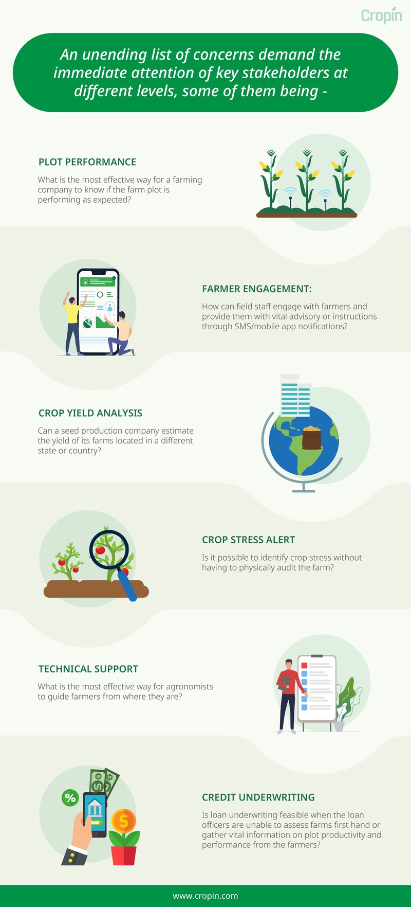
The above are only a handful of predicaments that an agribusiness may face during such stressful times, which therefore calls for innovative ways of going about business as usual. Smart farming solutions offer a wide array of capabilities to monitor and manage each stage of supply chain operations in an efficient manner without the need for someone to oversee it personally. In this regard, future-ready agri-tech solutions such as Cropin’s provide the right remedy to the many pain points of agri-focused enterprises.
Battling ‘Work From Home’ Restrictions With Cropin
For Cropin, one of the fundamental objectives of digitizing farm activities was to enable a high level of transparency from end to end of the supply chain. This means that specific users of Cropin’s application can monitor the productivity of farms and oversee operational tasks from within the confines of their office space or, in present-day circumstances, their homes.
SmartFarm, Cropin’s farm data management solution, leverages satellite monitoring to detect anomalies and predicts the health and yield of crops every 15 days. Cropin’s climate module also keeps tabs on changing weather conditions for every plot and provides appropriate weather-based advisory.
Cropin also facilitates direct engagement with farmers for the field staff to provide them with adequate support through crop production. Through AcreSquare’s mobile application for two-way communication, farmers can raise alerts and notify the concerned people about issues on the farm. In response, the agribusiness can either automatically send pre-configured advisory or manually trigger a response in the form of an SMS.
Further, the agribusiness can also configure instructions as per the activity schedule and push them to farmers as reminders through SMS, whenever the activity is due. Other messages can also be shared with farmers individually or in bulk as SMS and multimedia files such as images, PDF and word documents, videos, and web links that convey important information, in addition to weather alerts and news, can be shared through the AcreSquare app.
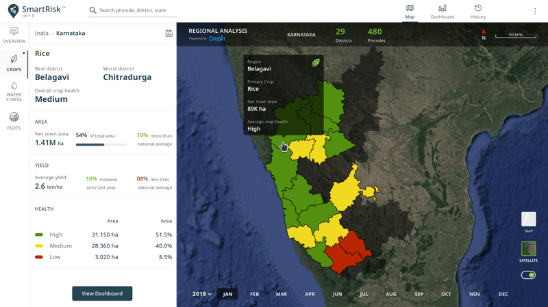
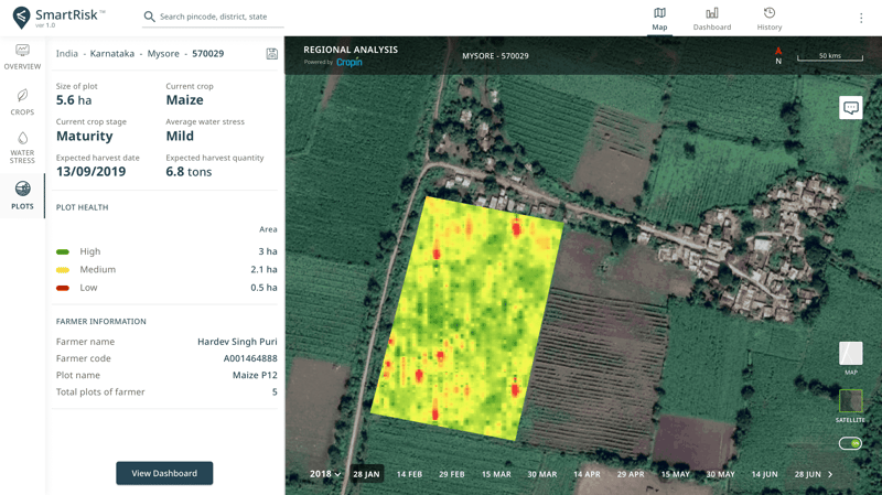
Cropin’s deep-learning engine SmartRisk leverages satellite-imaging-based data and AI-powered crop health analysis to remotely monitor the performance of every pixel at a farm, postcode, state, or country level across India. Interactive dashboards on the web-based application provide near-real-time insights to fuel data-driven decisions and effective risk mitigation. Ground-level intelligence on important aspects of crop production, supplemented by weather-forecast-based advisories, enables the management to take the right course of action for both farm and business operations.
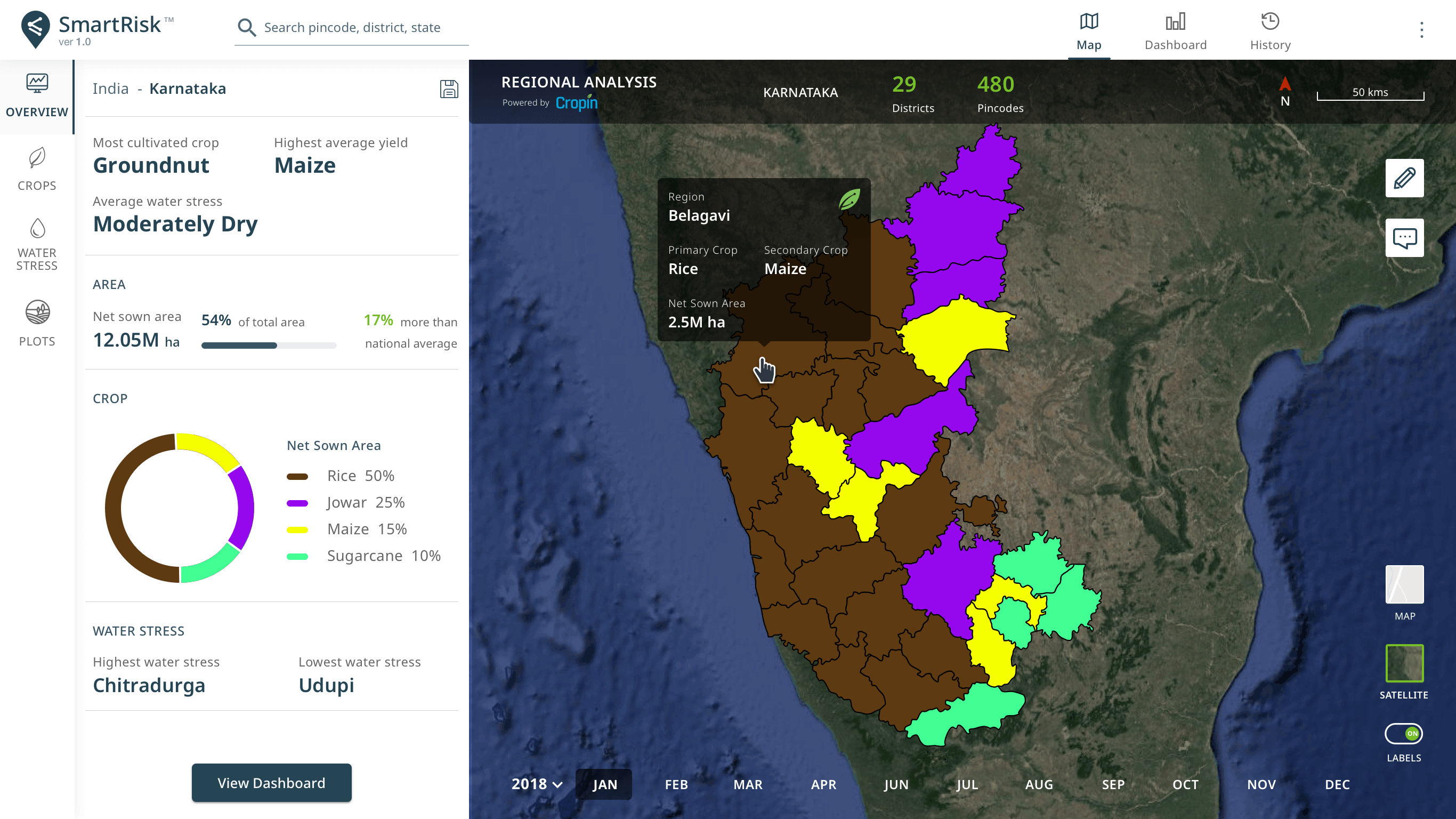
How do remote sensing capabilities improve the different aspects of cultivation and enable smarter farming decisions?
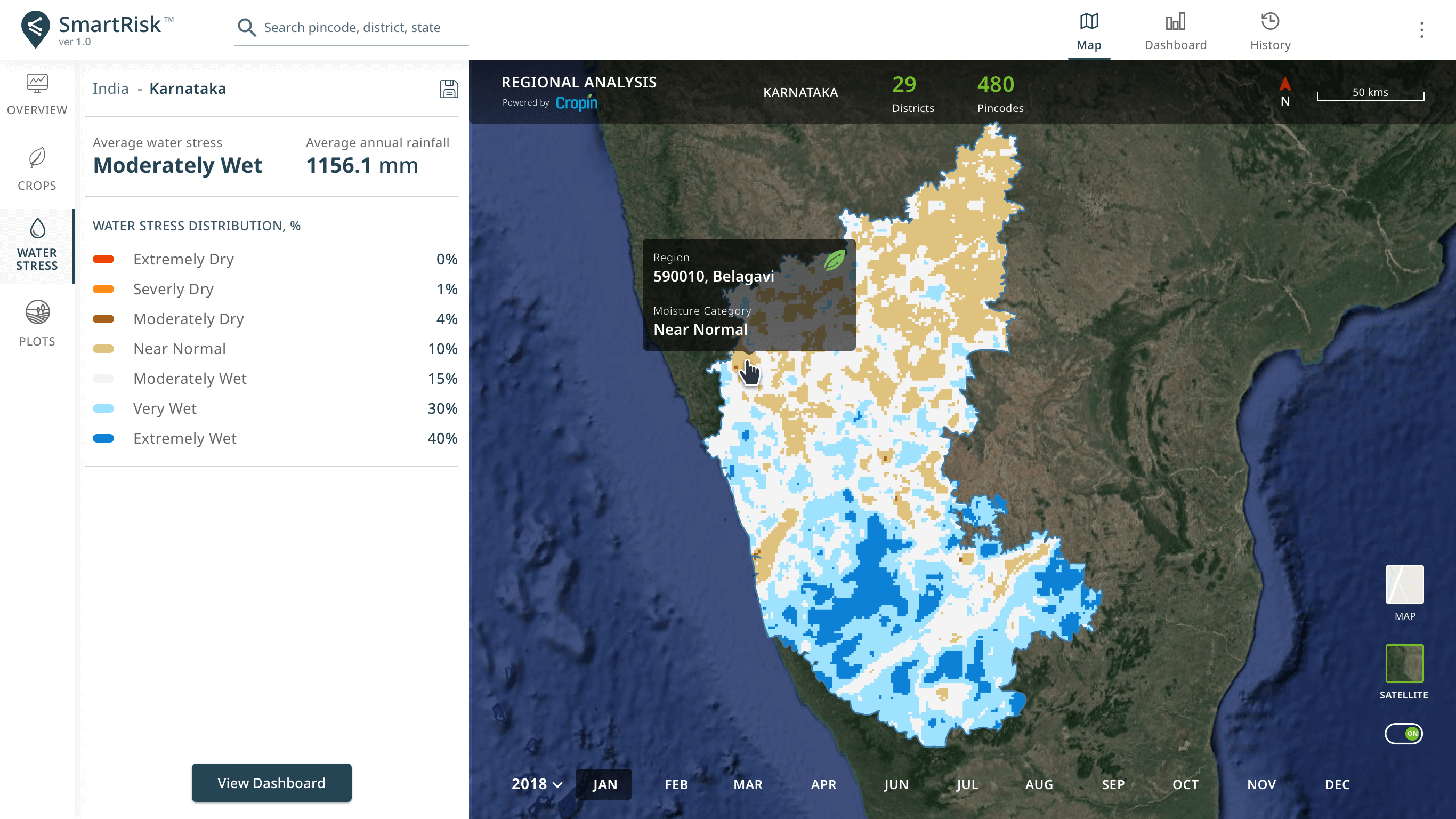
While working remotely, SmartFarm and SmartRisk can help you:
- Identify crops and determine the plot acreage based on satellite-imaging
- Analyze crop health and estimate yield with accuracy
- Obtain historical and predictive insights on plot performance
- Analyze water stress using remote sensing data
- Appraise farmers based on their plot’s productivity
Not just in agriculture, but across several other industries, what wasn’t considered a possibility earlier is now being tested and accepted globally. Technological advancements are breaking barriers and paving the path for progressive and digitally-enabled agriculture. If you have not tested the waters with a digital solution that could potentially create a competitive edge for your enterprise, now is the time to do so.


